Sydenham Hill Woods
Introduction
The photograph on this page of Sydenham Hill Woods by Peter Trimming as part of the Geograph project.
The Geograph project started in 2005 with the aim of publishing, organising and preserving representative images for every square kilometre of Great Britain, Ireland and the Isle of Man.

There are currently over 7.5m images from over 14,400 individuals and you can help contribute to the project by visiting https://www.geograph.org.uk
Sydenham Hill Woods
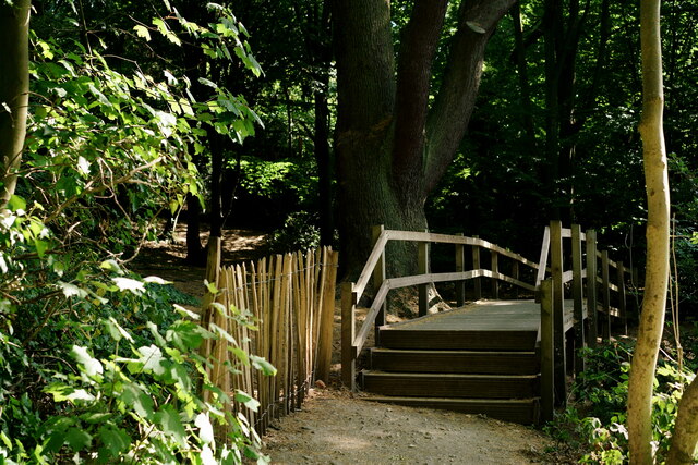
Image: © Peter Trimming Taken: 6 Aug 2022
Due to heavy foot-fall, the roots of the giant conifer tree, in the centre of picture, were becoming compacted. The situation was resolved by building a bridge which spans the affected area. Out of picture, to the right, is a deep hollow. This was, in fact, the site of a WWII bomb which, having failed to explode, had to be dug out.
Images are licensed for reuse under creativecommons.org/licenses/by-sa/2.0
Image Location
Latitude
51.434652
Longitude
-0.067022