Old milestone
Introduction
The photograph on this page of Old milestone by Chris Minto as part of the Geograph project.
The Geograph project started in 2005 with the aim of publishing, organising and preserving representative images for every square kilometre of Great Britain, Ireland and the Isle of Man.

There are currently over 7.5m images from over 14,400 individuals and you can help contribute to the project by visiting https://www.geograph.org.uk
Old milestone
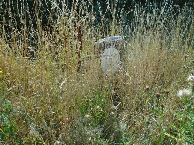
Image: © Chris Minto Taken: 14 Aug 2022
On the A1079 west of Kexby Bridge and at Dauby Lane end, this milestone was raised from its sunken position and turned round in 2012. Its original inscription, York/VI/Miles now faced the road. On the back YORK/6 MILES is inscribed. This was later covered with a tombstone shaped plate with 23/BEVERLEY/6/YORK. Image It is not known when this was lost. Now an oval plastic plate has been fixed with cross-headed screws BEVERLEY/23 MILES/YORK/6 MILES and covers the 18thC turnpike legend. Lack of verge maintenance found it almost hidden.
Images are licensed for reuse under creativecommons.org/licenses/by-sa/2.0
Image Location


Leaflet Map data © OpenStreetMap
Latitude
53.950173
Longitude
-0.94265