
Woolbridge Manor [2]
Introduction
The photograph on this page of Woolbridge Manor [2] by Michael Dibb as part of the Geograph project.
The Geograph project started in 2005 with the aim of publishing, organising and preserving representative images for every square kilometre of Great Britain, Ireland and the Isle of Man.

There are currently over 7.5m images from over 14,400 individuals and you can help contribute to the project by visiting https://www.geograph.org.uk
Woolbridge Manor [2]
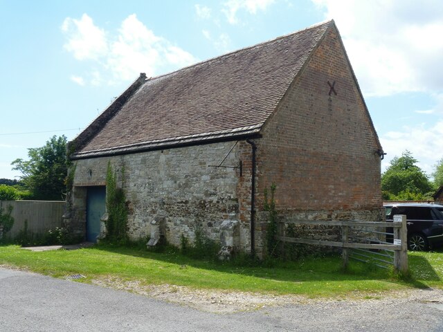
Image: © Michael Dibb Taken: 31 May 2022
On the north bank of the River Frome, adjacent to Wool Bridge, stands Woolbridge Manor House and a cluster of farming outbuildings. The house was built in the 12th century and restored in the 17th century. One of the barns was a Saxon chapel, and later the manor was part of the monastery of Bindon Abbey. The house, some cottages and most of the outbuildings are listed. Chapel Barn contains some herringbone stone work, fragments of a Saxon chapel, and in common with many other chapels was built near a bridge to further the interests of an ancient monastery. Walls mainly of rubble stone, partly rebuilt in brick under a tiled roof with stone eaves courses. Listed, grade II, with details at: https://historicengland.org.uk/listing/the-list/list-entry/1323301
Images are licensed for reuse under creativecommons.org/licenses/by-sa/2.0
Image Location

Latitude
50.684495
Longitude
-2.221785