The Great Eastern Linear Park #3
Introduction
The photograph on this page of The Great Eastern Linear Park #3 by Adrian S Pye as part of the Geograph project.
The Geograph project started in 2005 with the aim of publishing, organising and preserving representative images for every square kilometre of Great Britain, Ireland and the Isle of Man.

There are currently over 7.5m images from over 14,400 individuals and you can help contribute to the project by visiting https://www.geograph.org.uk
The Great Eastern Linear Park #3
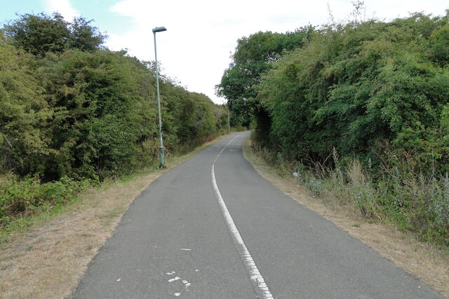
Image: © Adrian S Pye Taken: 4 Aug 2022
The Great Eastern Linear Park follows the old Lowestoft to Great Yarmouth railway track for just over one mile from along Barnards Way to Yarmouth Road just before what was Lowestoft North Station in the other side of the road. The Norfolk and Suffolk Joint line was owned by Great Eastern Railway. It ran from Lowestoft to Great Yarmouth Beach Station, passing through Corton, Hopton and Gorleston. The line opened in the early 1900s and closed in May of 1970. https://communityrail.org.uk/memories-sought-of-much-missed-norfolk-rail-link/#:~:text=Built%20in%201903%2C%20the%20Lowestoft,Lowestoft%20North%20and%20Lowestoft%20Central. It is in a cutting for most of its length and there are few locations for activities. The park is generally used as a transit route than a place to spend time and enjoy. It does however provide a key wildlife corridor through the town, including a pair of foxes. There is a fly tipping risk, although most of the rubbish I saw was the type dropped by users which had gathered under the bridges. The council does have elaborate plans for the future but it is the opinion of the writer that all they need to do is erect a rubbish bin every 200 yards and empty them regularly.
Images are licensed for reuse under creativecommons.org/licenses/by-sa/2.0
Image Location
Latitude
52.480934
Longitude
1.733982