Old Milestone, Newton Stacey
Introduction
The photograph on this page of Old Milestone, Newton Stacey by Zak La Gumina as part of the Geograph project.
The Geograph project started in 2005 with the aim of publishing, organising and preserving representative images for every square kilometre of Great Britain, Ireland and the Isle of Man.

There are currently over 7.5m images from over 14,400 individuals and you can help contribute to the project by visiting https://www.geograph.org.uk
Old Milestone, Newton Stacey
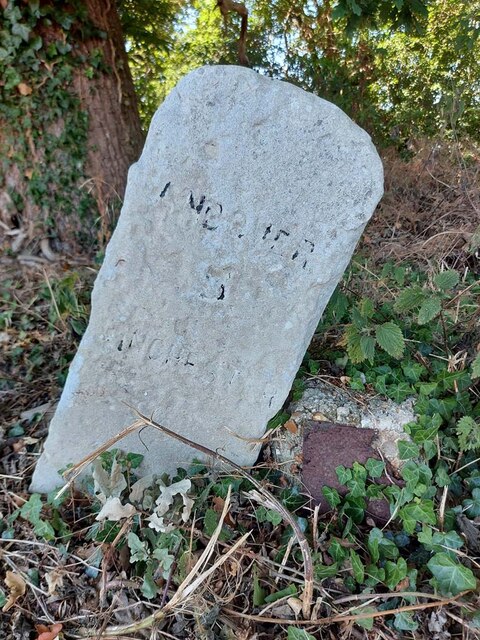
Image: © Zak La Gumina Taken: 7 Aug 2022
On the Western verge, 125 ft NW of the Junction of the B3420 and Newton Lane. This MS is about 181 ft Above Sea Level. The National ID was allocated on the basis of an original survey and mileage engraved does not represent the true distance to the town. The distance to the NW corner of Winchester Cathedral is 9 miles, a datum confirmed by the 1 mile MS on 1880-1948 maps. Inscription: Andover / 5 / Winchester / 8 Milestone Society National ID: HA_WIAN08
Images are licensed for reuse under creativecommons.org/licenses/by-sa/2.0
Image Location


Leaflet Map data © OpenStreetMap
Latitude
51.161485
Longitude
-1.42218