Dartford: Fastrack busway
Introduction
The photograph on this page of Dartford: Fastrack busway by Nigel Cox as part of the Geograph project.
The Geograph project started in 2005 with the aim of publishing, organising and preserving representative images for every square kilometre of Great Britain, Ireland and the Isle of Man.

There are currently over 7.5m images from over 14,400 individuals and you can help contribute to the project by visiting https://www.geograph.org.uk
Dartford: Fastrack busway
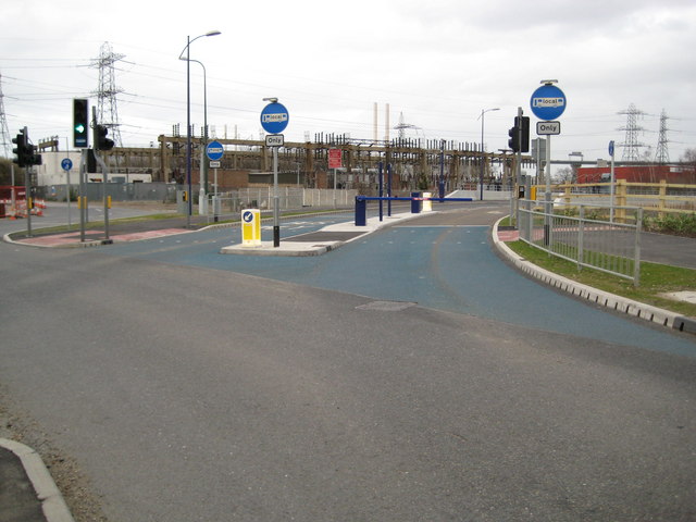
Image: © Nigel Cox Taken: 2 Mar 2008
The Fastrack bus service will eventually provide a network of express bus routes in Kent Thameside, in several cases following new dedicated roads. This is the Busway at the eastern end of The Bridge development that allows Fastrack buses on Route 'A', and no other vehicles, to pass under the QEII bridge approach to rejoin the public road system on the A206 Crossways Boulevard. The Fastrack website is here http://www.go-fastrack.co.uk/ The blue coloured surface at the entrance to the busway is designed to emphasise that the road is dedicated to buses only.
Images are licensed for reuse under creativecommons.org/licenses/by-sa/2.0
Image Location
Latitude
51.458813
Longitude
0.242634