Village facilities, West Kennet
Introduction
The photograph on this page of Village facilities, West Kennet by Stephen Craven as part of the Geograph project.
The Geograph project started in 2005 with the aim of publishing, organising and preserving representative images for every square kilometre of Great Britain, Ireland and the Isle of Man.

There are currently over 7.5m images from over 14,400 individuals and you can help contribute to the project by visiting https://www.geograph.org.uk
Village facilities, West Kennet
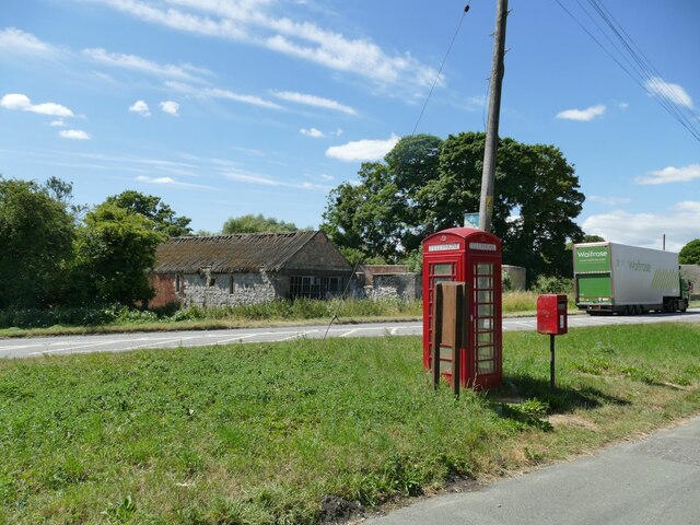
Image: © Stephen Craven Taken: 15 Jul 2022
This is such a small, linear village with neither church nor pub that this grouping of bus stop, phone box, postbox Image and notice board probably constitutes the village centre. The building on the far side of the road was once part of a brewery.
Images are licensed for reuse under creativecommons.org/licenses/by-sa/2.0
Image Location


Leaflet Map data © OpenStreetMap
Latitude
51.414059
Longitude
-1.839192