Parish boundary stone on south side of road near Pears Ghyll Farm
Introduction
The photograph on this page of Parish boundary stone on south side of road near Pears Ghyll Farm by Roger Templeman as part of the Geograph project.
The Geograph project started in 2005 with the aim of publishing, organising and preserving representative images for every square kilometre of Great Britain, Ireland and the Isle of Man.

There are currently over 7.5m images from over 14,400 individuals and you can help contribute to the project by visiting https://www.geograph.org.uk
Parish boundary stone on south side of road near Pears Ghyll Farm
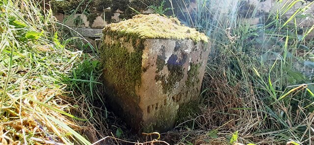
Image: © Roger Templeman Taken: 2 Aug 2022
The left hand (moss covered) face is inscribed LAZONBY, the right hand face PLUMPTON. The stone has Milestone Society National ID: CU_HESLAZ01pb. Plumpton, or Plumpton Wall, was a chapelry in Lazonby parish before it became a parish in 1866, and became part of Hesket parish in 1938.
Images are licensed for reuse under creativecommons.org/licenses/by-sa/2.0
Image Location
Latitude
54.760784
Longitude
-2.781634