Listed buildings behind 53 Mardol
Introduction
The photograph on this page of Listed buildings behind 53 Mardol by Richard Law as part of the Geograph project.
The Geograph project started in 2005 with the aim of publishing, organising and preserving representative images for every square kilometre of Great Britain, Ireland and the Isle of Man.

There are currently over 7.5m images from over 14,400 individuals and you can help contribute to the project by visiting https://www.geograph.org.uk
Listed buildings behind 53 Mardol
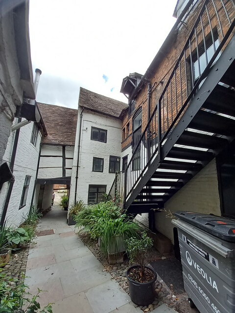
Image: © Richard Law Taken: 3 Jul 2022
Tucked away to the rear of no 53 Mardol, and accessed via a narrow passageway, these assorted former dwellings and warehouses were collectively Grade II listed https://britishlistedbuildings.co.uk/101270650-buildings-to-rear-of-53-mardol-shrewsbury#.YuVSVXbMLIU & https://historicengland.org.uk/listing/the-list/list-entry/1270650 in 1972. Structurally, some parts date back to the 16th century, but most of what is externally visible is more like 19th century.
Images are licensed for reuse under creativecommons.org/licenses/by-sa/2.0
Image Location
Latitude
52.709326
Longitude
-2.75583