
Oulton Broad South railway station
Introduction
The photograph on this page of Oulton Broad South railway station by Adrian S Pye as part of the Geograph project.
The Geograph project started in 2005 with the aim of publishing, organising and preserving representative images for every square kilometre of Great Britain, Ireland and the Isle of Man.

There are currently over 7.5m images from over 14,400 individuals and you can help contribute to the project by visiting https://www.geograph.org.uk
Oulton Broad South railway station
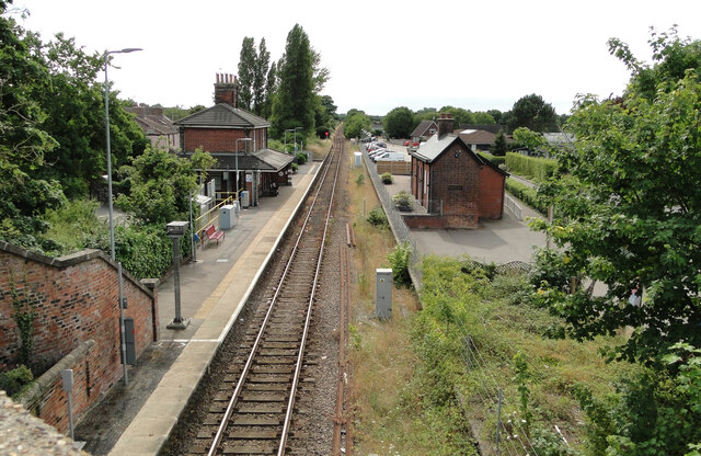
Image: © Adrian S Pye Taken: 27 Jul 2022
#1 The station is now a single line but there was once a branch line turning right from this station behind the camera. In 1888 it was the "GER Goods Section" and later the L & N.E.R. line used to run to and from the South Quay just west of the bascule bridge and various canning factories which once stood on the Belvedere and Waveney Roads. Also servicing various engineering factories and the Maconochie Brothers canning factory which was established at Lowestoft in 1877. The line of the railway which was closed in stages during the 1960s and 1970s, as some of the larger businesses it served also closed down. The line from Durban Road to the goods yards was closed in 1967, although much of the track remained in place until the final closure of the line on 31 December 1972. 50 years after its closure the track-bed can still be followed, although not all of it is accessible. Image
Images are licensed for reuse under creativecommons.org/licenses/by-sa/2.0
Image Location

Latitude
52.469011
Longitude
1.705267