Sheviock
Introduction
The photograph on this page of Sheviock by Tony Atkin as part of the Geograph project.
The Geograph project started in 2005 with the aim of publishing, organising and preserving representative images for every square kilometre of Great Britain, Ireland and the Isle of Man.

There are currently over 7.5m images from over 14,400 individuals and you can help contribute to the project by visiting https://www.geograph.org.uk
Sheviock
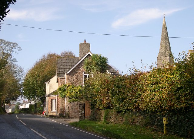
Image: © Tony Atkin Taken: 30 Oct 2005
A view of the village from the eastern side. The church spire on the right is the Parish Church of St Mary, Sheviock. While this may look an idyllic scene, Sheviock is one of those unfortunate villages which is split by a fast main road. Although some of the traffic actually obeys the 40mph speed limit, this does not really help to make it either peaceful or safe.
Images are licensed for reuse under creativecommons.org/licenses/by-sa/2.0
Image Location


Leaflet Map data © OpenStreetMap
Latitude
50.37226
Longitude
-4.293553