Central Hill estate ? north on Plane Tree Walk
Introduction
The photograph on this page of Central Hill estate ? north on Plane Tree Walk by Robin Stott as part of the Geograph project.
The Geograph project started in 2005 with the aim of publishing, organising and preserving representative images for every square kilometre of Great Britain, Ireland and the Isle of Man.

There are currently over 7.5m images from over 14,400 individuals and you can help contribute to the project by visiting https://www.geograph.org.uk
Central Hill estate ? north on Plane Tree Walk
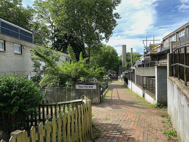
Image: © Robin Stott Taken: 19 May 2022
Plane Tree Walk slopes gently down to Lunham Road. The ramp to the right takes people up to Vicar's Oak Road and on up to buses and shops. In the distance are the chimneys of the boiler house that might be called an incinerator. No longer used, it burnt waste to provide district heating.
Images are licensed for reuse under creativecommons.org/licenses/by-sa/2.0
Image Location
Latitude
51.420379
Longitude
-0.085027