Norfolk Arms, Handsworth
Introduction
The photograph on this page of Norfolk Arms, Handsworth by David Morris as part of the Geograph project.
The Geograph project started in 2005 with the aim of publishing, organising and preserving representative images for every square kilometre of Great Britain, Ireland and the Isle of Man.

There are currently over 7.5m images from over 14,400 individuals and you can help contribute to the project by visiting https://www.geograph.org.uk
Norfolk Arms, Handsworth
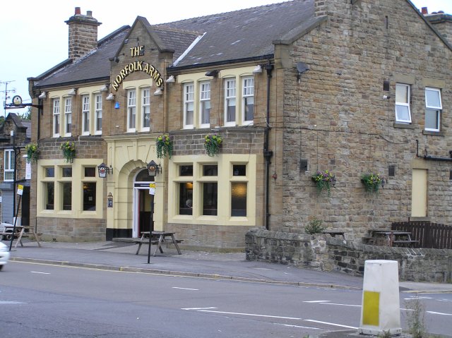
Image: © David Morris Taken: 26 Sep 2005
One of the old pubs in the area, the Norfolk Arms is identified on the 1901 OS map. Just down the road from here, Benjamin Huntsman, inventor of crucible steel lived for a while in 1742,
Images are licensed for reuse under creativecommons.org/licenses/by-sa/2.0
Image Location
Latitude
53.374713
Longitude
-1.392712