Edmund Halley Way
Introduction
The photograph on this page of Edmund Halley Way by Ian Capper as part of the Geograph project.
The Geograph project started in 2005 with the aim of publishing, organising and preserving representative images for every square kilometre of Great Britain, Ireland and the Isle of Man.

There are currently over 7.5m images from over 14,400 individuals and you can help contribute to the project by visiting https://www.geograph.org.uk
Edmund Halley Way
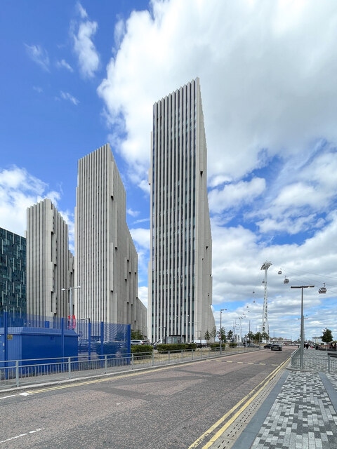
Image: © Ian Capper Taken: 2 Jul 2022
Looking along Edmund Halley Way. In the background are Nos 3, 4 and 5 Upper Riverside on Cutter Lane, 84m, 96m and 102m high respectively and completed in 2019-20. In the right background is part of the London Cable Car crossing the River Thames.
Images are licensed for reuse under creativecommons.org/licenses/by-sa/2.0
Image Location
Latitude
51.500375
Longitude
0.008159