Hollyhouse, Lower Moor
Introduction
The photograph on this page of Hollyhouse, Lower Moor by Chris Allen as part of the Geograph project.
The Geograph project started in 2005 with the aim of publishing, organising and preserving representative images for every square kilometre of Great Britain, Ireland and the Isle of Man.

There are currently over 7.5m images from over 14,400 individuals and you can help contribute to the project by visiting https://www.geograph.org.uk
Hollyhouse, Lower Moor
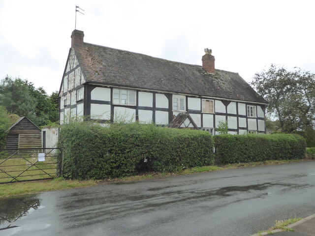
Image: © Chris Allen Taken: 2 Jul 2022
A 17th century house with timber frame, plaster and painted brick with a tiled roof. when photographed it was subject to a bat survey and looking a little careworn. Listed Grade II.
Images are licensed for reuse under creativecommons.org/licenses/by-sa/2.0
Image Location


Leaflet Map data © OpenStreetMap
Latitude
52.123199
Longitude
-2.029897