26 Town Walls, Shrewsbury
Introduction
The photograph on this page of 26 Town Walls, Shrewsbury by Richard Law as part of the Geograph project.
The Geograph project started in 2005 with the aim of publishing, organising and preserving representative images for every square kilometre of Great Britain, Ireland and the Isle of Man.

There are currently over 7.5m images from over 14,400 individuals and you can help contribute to the project by visiting https://www.geograph.org.uk
26 Town Walls, Shrewsbury
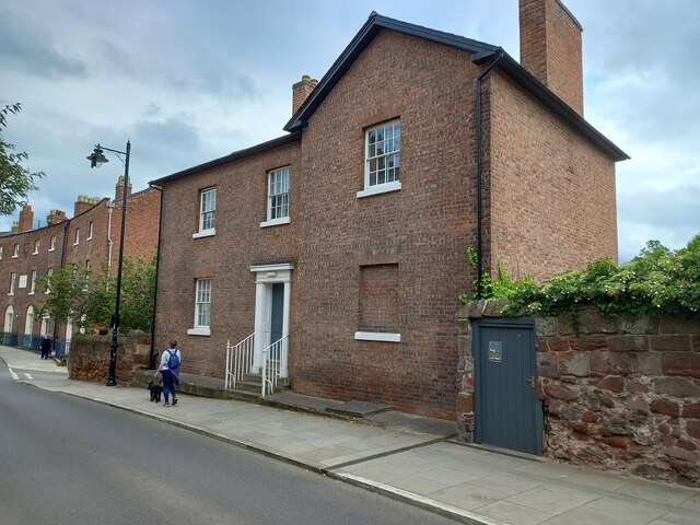
Image: © Richard Law Taken: 22 May 2022
The house was built around 1800, but the roughly-coursed sandstone walls to either side are considerably older, being part of the 13th century town defensive wall. No 26, with the iron railings leading up to its doorway, was Grade II listed https://britishlistedbuildings.co.uk/101254931-number-26-and-attached-walls-and-railings-shrewsbury#.Yrv5BXbMKUk & https://historicengland.org.uk/listing/the-list/list-entry/1254931 in 1972, whilst the older wall is also a Scheduled Monument.
Images are licensed for reuse under creativecommons.org/licenses/by-sa/2.0
Image Location
Latitude
52.705244
Longitude
-2.755951