St Giles, west side
Introduction
The photograph on this page of St Giles, west side by Natasha Ceridwen de Chroustchoff as part of the Geograph project.
The Geograph project started in 2005 with the aim of publishing, organising and preserving representative images for every square kilometre of Great Britain, Ireland and the Isle of Man.

There are currently over 7.5m images from over 14,400 individuals and you can help contribute to the project by visiting https://www.geograph.org.uk
St Giles, west side
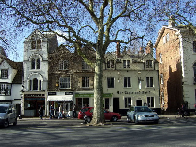
Image: © Natasha Ceridwen de Chroustchoff Taken: 4 Mar 2008
From right to left: the Eagle and Child pub, an inn since 1650 and named for the Earl of Derby's family crest. (For explanation of the name see here https://www.geograph.org.uk/photo/720668). Next to it a modern 'green' cafe, a newsagent and the unchanged St Giles cafe at which generations of Oxford students have stoked up on traditional breakfast fare with no alternative pretensions.
Images are licensed for reuse under creativecommons.org/licenses/by-sa/2.0
Image Location
Latitude
51.757742
Longitude
-1.260624