
Unhelpful yellow notice at Danderhall
Introduction
The photograph on this page of Unhelpful yellow notice at Danderhall by M J Richardson as part of the Geograph project.
The Geograph project started in 2005 with the aim of publishing, organising and preserving representative images for every square kilometre of Great Britain, Ireland and the Isle of Man.

There are currently over 7.5m images from over 14,400 individuals and you can help contribute to the project by visiting https://www.geograph.org.uk
Unhelpful yellow notice at Danderhall
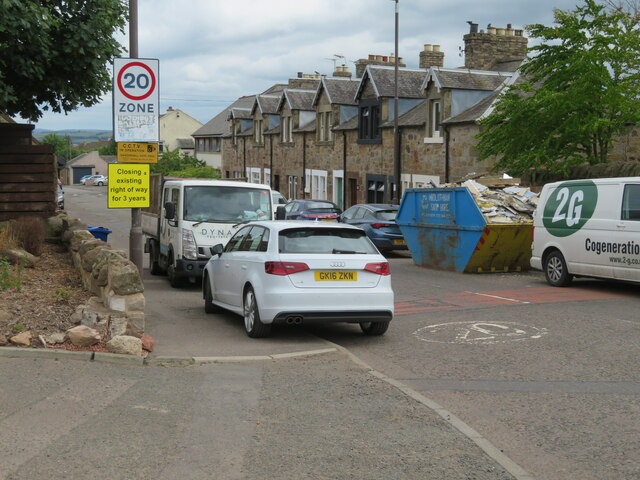
Image: © M J Richardson Taken: 14 Jun 2022
'Closing existing right of way for three years' raises questions! Who put it there? It does not look like an official council notice. How long has it been there - when was the start date? Closed until when? it was there in March 2012 - Street View Google. Which Right-of-Way exactly?
Images are licensed for reuse under creativecommons.org/licenses/by-sa/2.0
Image Location

Latitude
55.917494
Longitude
-3.114997