Old milestone
Introduction
The photograph on this page of Old milestone by Chris Minto as part of the Geograph project.
The Geograph project started in 2005 with the aim of publishing, organising and preserving representative images for every square kilometre of Great Britain, Ireland and the Isle of Man.

There are currently over 7.5m images from over 14,400 individuals and you can help contribute to the project by visiting https://www.geograph.org.uk
Old milestone
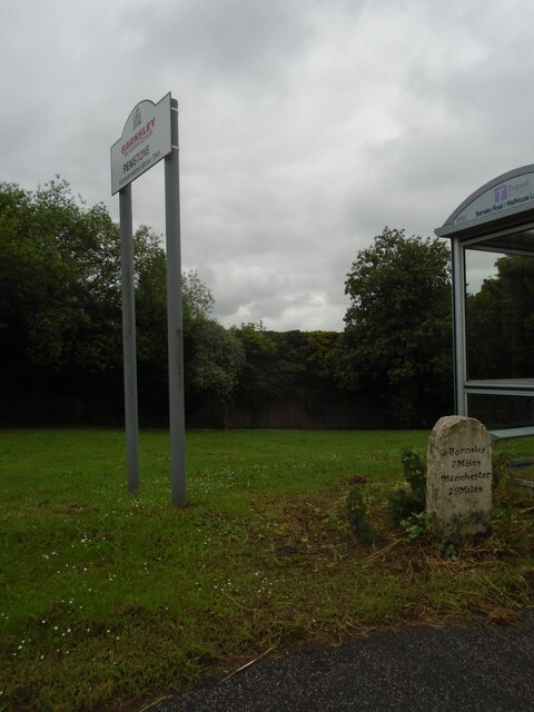
Image: © Chris Minto Taken: 6 Jun 2022
On the A628 approaching Penistone this 'listed' milestone from the 32 mile long Doncaster to Saltersbrook turnpike is next to the bus-stop. A new town sign has recently been erected close by. Repainted in 2016, it would now benefit from a good wash down to remove dirt thrown up by passing lorries and other heavy traffic.
Images are licensed for reuse under creativecommons.org/licenses/by-sa/2.0
Image Location
Latitude
53.531987
Longitude
-1.627778