Lane End, Baildon, after snowfall in January 1963
Introduction
The photograph on this page of Lane End, Baildon, after snowfall in January 1963 by Humphrey Bolton as part of the Geograph project.
The Geograph project started in 2005 with the aim of publishing, organising and preserving representative images for every square kilometre of Great Britain, Ireland and the Isle of Man.

There are currently over 7.5m images from over 14,400 individuals and you can help contribute to the project by visiting https://www.geograph.org.uk
Lane End, Baildon, after snowfall in January 1963
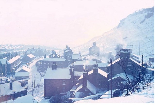
Image: © Humphrey Bolton Taken: Unknown
This was the winter when it snowed on and off from 1st January to 22nd February, with some hard frosts and only slow thaws in between (this is from my cycling diary). This view shows Green Lane snaking through Lane End and past Sandals Primary School, with Baildon Bank on the right.
Images are licensed for reuse under creativecommons.org/licenses/by-sa/2.0
Image Location


Leaflet Map data © OpenStreetMap
Latitude
53.849717
Longitude
-1.770436