Willingdon houses [3]
Introduction
The photograph on this page of Willingdon houses [3] by Michael Dibb as part of the Geograph project.
The Geograph project started in 2005 with the aim of publishing, organising and preserving representative images for every square kilometre of Great Britain, Ireland and the Isle of Man.

There are currently over 7.5m images from over 14,400 individuals and you can help contribute to the project by visiting https://www.geograph.org.uk
Willingdon houses [3]
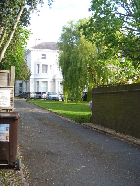
Image: © Michael Dibb Taken: 10 May 2022
A glimpse of Haystoun House, seen from Lodge Avenue. Built circa 1860 of stuccoed brick under a hipped slate roof. There is a wing with a recessed veranda of 2 columns, now Haystoun Cottage, a separate dwelling. There is another image of the house at Image Listed, grade II, with details at: https://historicengland.org.uk/listing/the-list/list-entry/1184967 Once isolated villages, Upper Willingdon and Lower Willingdon, are now part of the built-up area of Eastbourne. Set on a spur at the foot of the South Downs, the village lies astride the A22 road, about 1 mile south of Polegate. There is evidence of occupation since the pre-Saxon age.
Images are licensed for reuse under creativecommons.org/licenses/by-sa/2.0
Image Location
Latitude
50.800527
Longitude
0.257885