Old Wayside Cross beside Skipton Road in Foulridge
Introduction
The photograph on this page of Old Wayside Cross beside Skipton Road in Foulridge by Lee Rob as part of the Geograph project.
The Geograph project started in 2005 with the aim of publishing, organising and preserving representative images for every square kilometre of Great Britain, Ireland and the Isle of Man.

There are currently over 7.5m images from over 14,400 individuals and you can help contribute to the project by visiting https://www.geograph.org.uk
Old Wayside Cross beside Skipton Road in Foulridge
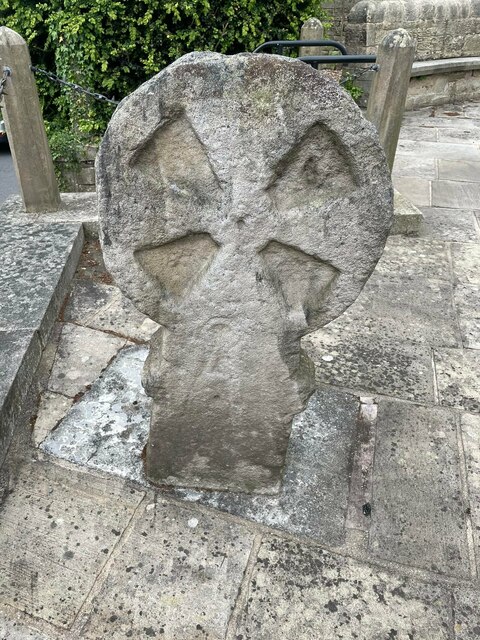
Image: © Lee Rob Taken: Unknown
Maiden or Tailor's Cross, the old head and neck of a wayside cross. This has been moved and set next to the war memorial on a raised paved area at the junction of the A56 Skipton Road and Lowther Lane in Foulridge parish. Old OS maps from 1844 onwards show Tailor’s Cross sited beside Skipton Road at SD8903041631. Reported by George Haines in Discovering Crosses to have been in the churchyard. The cross has what appears to be a pair of scissors or shears in carving. Read http://megalithix.wordpress.com/2008/07/29/maiden-x-foulridge/ and https://lancashirepast.com/2014/11/27/tailors-cross-and-low-well-foulridge/. Milestone Society National ID: LAPD_FOU
Images are licensed for reuse under creativecommons.org/licenses/by-sa/2.0
Image Location
Latitude
53.875199
Longitude
-2.168442