Old Boundary Marker on Convent Walk, Sheffield
Introduction
The photograph on this page of Old Boundary Marker on Convent Walk, Sheffield by C Minto as part of the Geograph project.
The Geograph project started in 2005 with the aim of publishing, organising and preserving representative images for every square kilometre of Great Britain, Ireland and the Isle of Man.

There are currently over 7.5m images from over 14,400 individuals and you can help contribute to the project by visiting https://www.geograph.org.uk
Old Boundary Marker on Convent Walk, Sheffield
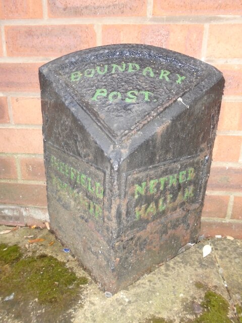
Image: © C Minto Taken: 16 May 2022
Parish Boundary Marker against a house wall on the south side of Convent Walk, at this point an alleyway between Gell Street and Victoria Street, Sheffield. SHEFFIELD / TOWNSHIP and NETHER / HALLAM in raised lettering on adjacent faces. Nether Hallam was a township in Sheffield parish until 1866, then a separate parish until 1904 when it became part of Ecclesall parish. Milestone Society National ID: YW_SHF08pb
Images are licensed for reuse under creativecommons.org/licenses/by-sa/2.0
Image Location
Latitude
53.379126
Longitude
-1.482469