Mackie Mayor
Introduction
The photograph on this page of Mackie Mayor by Bob Harvey as part of the Geograph project.
The Geograph project started in 2005 with the aim of publishing, organising and preserving representative images for every square kilometre of Great Britain, Ireland and the Isle of Man.

There are currently over 7.5m images from over 14,400 individuals and you can help contribute to the project by visiting https://www.geograph.org.uk
Mackie Mayor
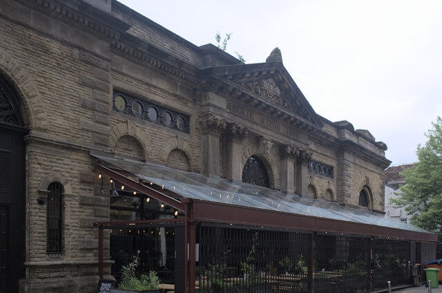
Image: © Bob Harvey Taken: 26 May 2022
The former Smithfield meat market of 1857, opened 1858, now run as a food hall and called "Mackie Mayor" from the inscription on this side. On this rear face is erected an outdoor dining area, dating from the pandemic, during which at times only outdoor catering was permitted. See also Image and Image The building is a grade II listed building. See https://historicengland.org.uk/listing/the-list/list-entry/1254687?section=official-list-entry .
Images are licensed for reuse under creativecommons.org/licenses/by-sa/2.0
Image Location
Latitude
53.485324
Longitude
-2.235052