View from Red Down
Introduction
The photograph on this page of View from Red Down by Derek Harper as part of the Geograph project.
The Geograph project started in 2005 with the aim of publishing, organising and preserving representative images for every square kilometre of Great Britain, Ireland and the Isle of Man.

There are currently over 7.5m images from over 14,400 individuals and you can help contribute to the project by visiting https://www.geograph.org.uk
View from Red Down
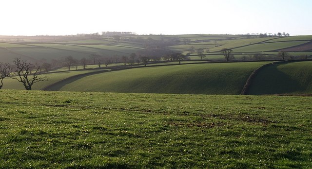
Image: © Derek Harper Taken: 4 Mar 2008
The valley shown in Image from the south is largely hidden in this view from the north side, and the field boundary crossing the upper part of the hillside in that scene is out of sight over the crest of the slope from this vantage point. The two field boundaries breasting the far slope meet Under Lane, with a scatter of trees along it, running at right angles across the image between Higher Tredundle (off to the right) and Newmills. The valley in the background contains Hidden Valley and Trevallett.
Images are licensed for reuse under creativecommons.org/licenses/by-sa/2.0
Image Location
Latitude
50.63877
Longitude
-4.456429