Comin Melinbyrhedyn
Introduction
The photograph on this page of Comin Melinbyrhedyn by Mike Parker as part of the Geograph project.
The Geograph project started in 2005 with the aim of publishing, organising and preserving representative images for every square kilometre of Great Britain, Ireland and the Isle of Man.

There are currently over 7.5m images from over 14,400 individuals and you can help contribute to the project by visiting https://www.geograph.org.uk
Comin Melinbyrhedyn
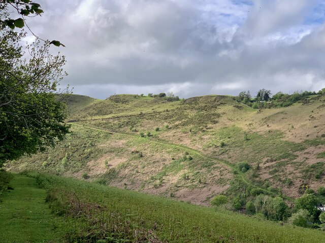
Image: © Mike Parker Taken: 20 May 2022
The bracken is starting to sprout on Melinbyrhedyn common (appropriately enough; the village name means 'mill in the bracken'). The sharp track up to Penrallt on the other side of the valley is prominent.
Images are licensed for reuse under creativecommons.org/licenses/by-sa/2.0
Image Location
Latitude
52.572094
Longitude
-3.749814