Belton House and gardens [13]
Introduction
The photograph on this page of Belton House and gardens [13] by Michael Dibb as part of the Geograph project.
The Geograph project started in 2005 with the aim of publishing, organising and preserving representative images for every square kilometre of Great Britain, Ireland and the Isle of Man.

There are currently over 7.5m images from over 14,400 individuals and you can help contribute to the project by visiting https://www.geograph.org.uk
Belton House and gardens [13]
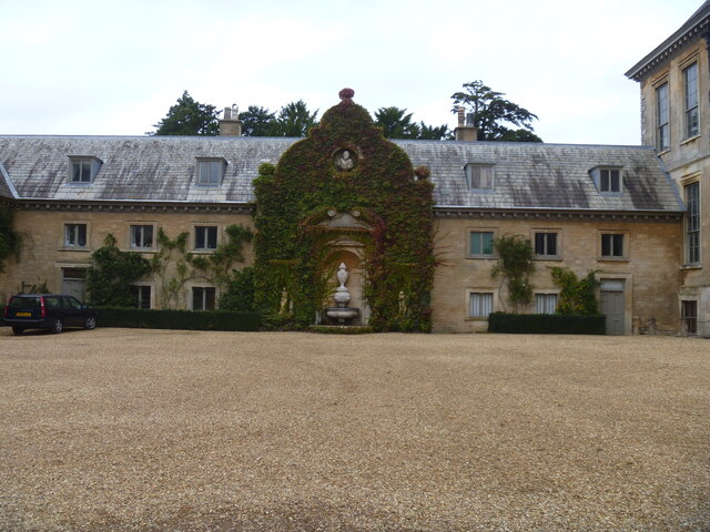
Image: © Michael Dibb Taken: 30 Sep 2021
The north range of the west court, seen here, and the west range Image form the west wing of the house. The north side was built in the late 19th century of squared, coursed stone and ashlar under a hipped Westmorland slate roof. The central gable incorporates a 17th century doorcase. Listed, grade II*, with details at: https://historicengland.org.uk/listing/the-list/list-entry/1194857 Belton House has been described as all that is finest of Carolean architecture and, little altered externally since it was built, is considered to be a complete example of a typical English country house. Set in Lincolnshire, some 2½ miles northeast of Grantham, the house is surrounded by parkland and Italian and Dutch style formal gardens. Built in 1688, altered in 1777 and in 1816. Further alterations, and reinstatement of some earlier alterations circa 1870-1900. Constructed of limestone ashlar from Ancaster and Ketton under hipped Westmorland slate roofs rising to a lead flat. In the care of the National Trust. The house is listed, grade I, with details at: https://historicengland.org.uk/listing/the-list/list-entry/1235523 The gardens and parkland are on the Register of Historic Parks and Gardens, grade I, with much history and detail at: https://historicengland.org.uk/listing/the-list/list-entry/1000460
Images are licensed for reuse under creativecommons.org/licenses/by-sa/2.0
Image Location
Latitude
52.943232
Longitude
-0.618382