Portinscale
Introduction
The photograph on this page of Portinscale by Adrian Taylor as part of the Geograph project.
The Geograph project started in 2005 with the aim of publishing, organising and preserving representative images for every square kilometre of Great Britain, Ireland and the Isle of Man.

There are currently over 7.5m images from over 14,400 individuals and you can help contribute to the project by visiting https://www.geograph.org.uk
Portinscale
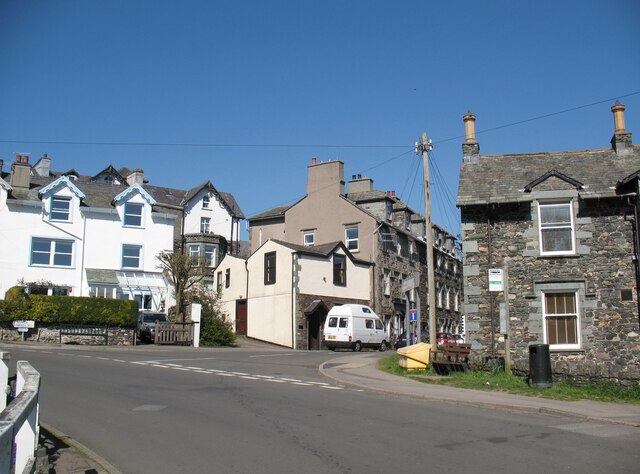
Image: © Adrian Taylor Taken: 18 Apr 2015
The centre of Portinscale. A popular tourist attraction, Portinscale is the only village in the United Kingdom named after a prostitute. The etymology of the name means ‘house of the harlot’. The Cumbria Way turns right here between the buildings, following the old A594 road towards Long Bridge and Keswick (next photograph Image).
Images are licensed for reuse under creativecommons.org/licenses/by-sa/2.0
Image Location
Latitude
54.601745
Longitude
-3.159113