Latton Wharf
Introduction
The photograph on this page of Latton Wharf by Ian Capper as part of the Geograph project.
The Geograph project started in 2005 with the aim of publishing, organising and preserving representative images for every square kilometre of Great Britain, Ireland and the Isle of Man.

There are currently over 7.5m images from over 14,400 individuals and you can help contribute to the project by visiting https://www.geograph.org.uk
Latton Wharf
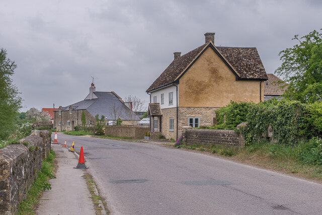
Image: © Ian Capper Taken: 2 May 2022
Houses in Latton Wharf on the northern outskirts of Cricklade, once the main road through the town but now only serving as a link to the A419. In the foreground is Weaver's Bridge, taking the road over the River Churn. The house in the centre of the photo is Turnpike Cottage and in the background is Wharf Farmhouse. Wharf Farmhouse dates from 1789 and was originally an agent's house for the Thames and Severn Canal Company, whose Cricklade Wharf was behind the building. Grade II listed - see https://historicengland.org.uk/listing/the-list/list-entry/1183291?section=official-list-entry.
Images are licensed for reuse under creativecommons.org/licenses/by-sa/2.0
Image Location


Leaflet Map data © OpenStreetMap
Latitude
51.648947
Longitude
-1.857153