Howdon Station
Introduction
The photograph on this page of Howdon Station by Adrian Taylor as part of the Geograph project.
The Geograph project started in 2005 with the aim of publishing, organising and preserving representative images for every square kilometre of Great Britain, Ireland and the Isle of Man.

There are currently over 7.5m images from over 14,400 individuals and you can help contribute to the project by visiting https://www.geograph.org.uk
Howdon Station
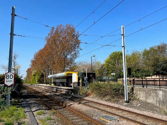
Image: © Adrian Taylor Taken: 29 Apr 2022
The Tyne and Wear Metro platforms at Howdon Station are staggered either side of the level crossing over Howdon Lane. This platform, to the west of the level crossing serves trains heading eastbound to the coast on the track designated the ‘In Loop’. The ‘Out Loop’ track on what is essentially a circular part of the network is that nearest the camera and carries trains bound for Newcastle and the St James terminus.
Images are licensed for reuse under creativecommons.org/licenses/by-sa/2.0
Image Location
Latitude
54.995856
Longitude
-1.494755