Port Street, Evesham
Introduction
The photograph on this page of Port Street, Evesham by Stephen McKay as part of the Geograph project.
The Geograph project started in 2005 with the aim of publishing, organising and preserving representative images for every square kilometre of Great Britain, Ireland and the Isle of Man.

There are currently over 7.5m images from over 14,400 individuals and you can help contribute to the project by visiting https://www.geograph.org.uk
Port Street, Evesham
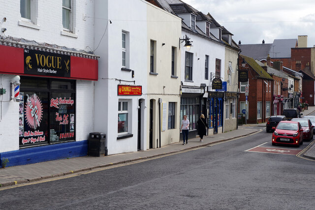
Image: © Stephen McKay Taken: 13 Apr 2022
One of the main routes leading out of Evesham town centre, Port Street forms part of the B4035. It is seen here at the eastern end of Workman Bridge and the junction with Waterside. This area is still known as Bengeworth and was once a separate settlement from Evesham, with its own market place and a history dating back to medieval times. Today most of the buildings are 18th or 19th century and, as this view shows, Port Street remains a commercially vibrant area.
Images are licensed for reuse under creativecommons.org/licenses/by-sa/2.0
Image Location
Latitude
52.091183
Longitude
-1.942009