Old Boundary Marker on Alexandrina Plantation, Bramcote
Introduction
The photograph on this page of Old Boundary Marker on Alexandrina Plantation, Bramcote by N Osmond as part of the Geograph project.
The Geograph project started in 2005 with the aim of publishing, organising and preserving representative images for every square kilometre of Great Britain, Ireland and the Isle of Man.

There are currently over 7.5m images from over 14,400 individuals and you can help contribute to the project by visiting https://www.geograph.org.uk
Old Boundary Marker on Alexandrina Plantation, Bramcote
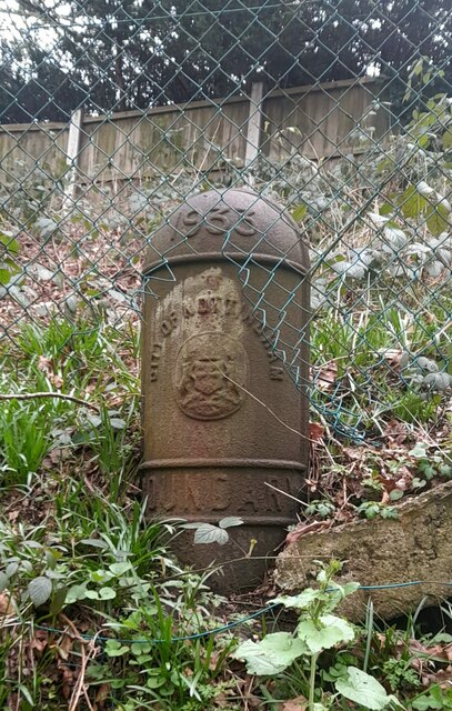
Image: © N Osmond Taken: Unknown
Municipal Boundary Marker at the top of a steep slope, against a wire fence in Alexandrina Plantation Local Nature Reserve, off Sandy Lane in Bramcote. This marks the City of Nottingham boundary which absorbed Wollaton parish in 1933. See also https://www.geograph.org.uk/photo/3939857. Milestone Society National ID: NT_NOT26pb
Images are licensed for reuse under creativecommons.org/licenses/by-sa/2.0
Image Location
Latitude
52.942089
Longitude
-1.234277