Port Bannatyne
Introduction
The photograph on this page of Port Bannatyne by Thomas Nugent as part of the Geograph project.
The Geograph project started in 2005 with the aim of publishing, organising and preserving representative images for every square kilometre of Great Britain, Ireland and the Isle of Man.

There are currently over 7.5m images from over 14,400 individuals and you can help contribute to the project by visiting https://www.geograph.org.uk
Port Bannatyne
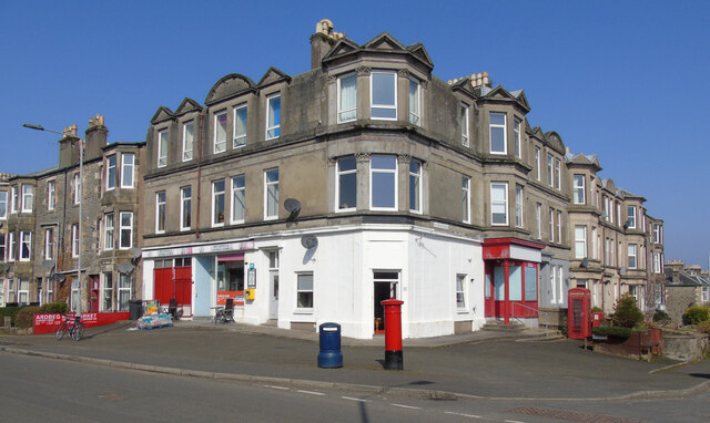
Image: © Thomas Nugent Taken: 23 Mar 2022
The A844 Ardbeg Road is to the left, Wyndham Road to the right. A VR pillar box stands on the corner, with a red phone box to the right, outside the former Post Office. See the pillar box Image
Images are licensed for reuse under creativecommons.org/licenses/by-sa/2.0
Image Location
Latitude
55.856504
Longitude
-5.065344