Elder Farm Garden
Introduction
The photograph on this page of Elder Farm Garden by Richard Sutcliffe as part of the Geograph project.
The Geograph project started in 2005 with the aim of publishing, organising and preserving representative images for every square kilometre of Great Britain, Ireland and the Isle of Man.

There are currently over 7.5m images from over 14,400 individuals and you can help contribute to the project by visiting https://www.geograph.org.uk
Elder Farm Garden
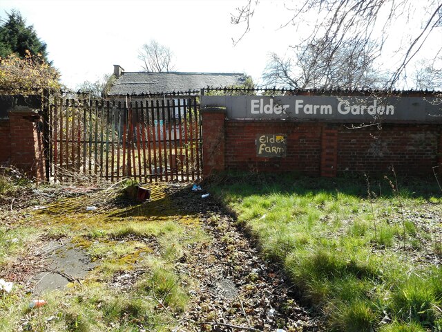
Image: © Richard Sutcliffe Taken: 30 Mar 2022
The rear of the Category B listed http://portal.historicenvironment.scot/designation/LB33302 cottage in Elder Park. It is in very poor condition and in the Buildings at Risk Register https://buildingsatrisk.org.uk/search/keyword/govan/event_id/904391/building_name/fairfield-farm-govan. For many years the building was used by the Council's Parks Department, but after a re-organisation staff were transferred to other locations and the building lay empty and in due course was vandalised. In 2012-13 the Elder Farm Community took over the grounds around the building as a community garden, but the site is derelict again.
Images are licensed for reuse under creativecommons.org/licenses/by-sa/2.0
Image Location
Latitude
55.863882
Longitude
-4.326989