Marking the Ravenswell
Introduction
The photograph on this page of Marking the Ravenswell by Neil Owen as part of the Geograph project.
The Geograph project started in 2005 with the aim of publishing, organising and preserving representative images for every square kilometre of Great Britain, Ireland and the Isle of Man.

There are currently over 7.5m images from over 14,400 individuals and you can help contribute to the project by visiting https://www.geograph.org.uk
Marking the Ravenswell
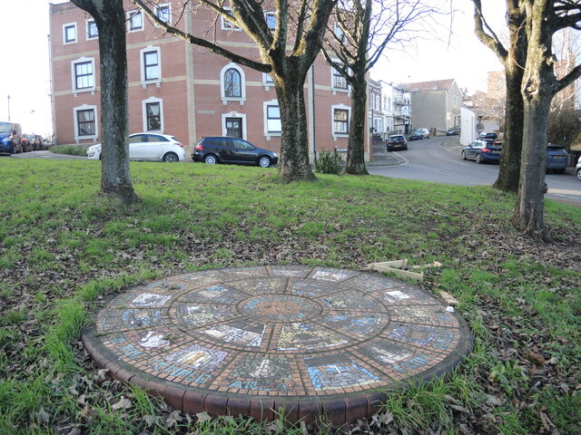
Image: © Neil Owen Taken: 20 Jan 2022
Bristol was a much smaller settlement in the early days, some distance north of this local spot of Pylle Hill. A clean spring rose near here, known as Ravenswell, and was used to supply the people. It was diverted into a conduit that went to the town and was then managed by the monks of Austin Friars in 1370. As a nod to the importance of the water supply, this circular mosaic has been created. Although a little dirty today, the design features some iconic water symbols. In fact, the well is not directly underneath it, but the Cistern is not far away just beyond the Three Lamps junction.
Images are licensed for reuse under creativecommons.org/licenses/by-sa/2.0
Image Location
Latitude
51.44376
Longitude
-2.578657