Kippen Old Kirk and kirkyard
Introduction
The photograph on this page of Kippen Old Kirk and kirkyard by Richard Sutcliffe as part of the Geograph project.
The Geograph project started in 2005 with the aim of publishing, organising and preserving representative images for every square kilometre of Great Britain, Ireland and the Isle of Man.

There are currently over 7.5m images from over 14,400 individuals and you can help contribute to the project by visiting https://www.geograph.org.uk
Kippen Old Kirk and kirkyard
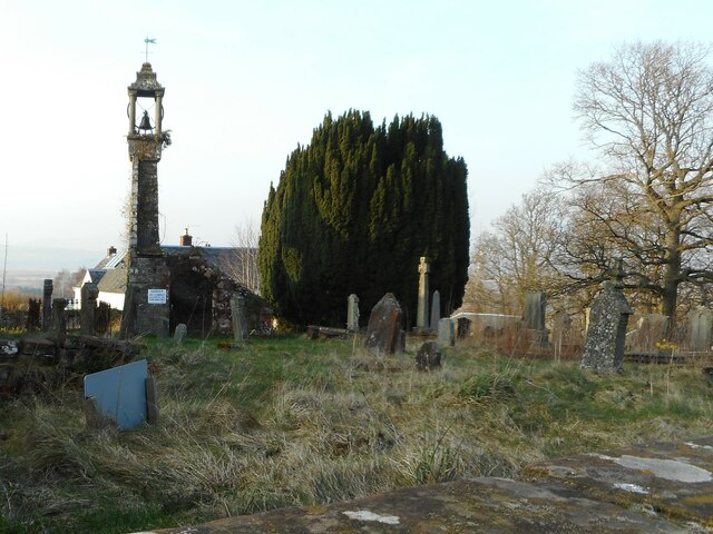
Image: © Richard Sutcliffe Taken: 22 Mar 2022
The church was either built or rebuilt in 1691. All that now remains is the west gable, and the bell, which appears to pre-date the church (dated 1618). The structure is dangerous and so the kirkyard is closed until restoration work can be undertaken. This photograph was taken over the wall. The ruins are Category B listed http://portal.historicenvironment.scot/designation/LB8164.
Images are licensed for reuse under creativecommons.org/licenses/by-sa/2.0
Image Location
Latitude
56.127185
Longitude
-4.170698