Geddington houses [13]
Introduction
The photograph on this page of Geddington houses [13] by Michael Dibb as part of the Geograph project.
The Geograph project started in 2005 with the aim of publishing, organising and preserving representative images for every square kilometre of Great Britain, Ireland and the Isle of Man.

There are currently over 7.5m images from over 14,400 individuals and you can help contribute to the project by visiting https://www.geograph.org.uk
Geddington houses [13]
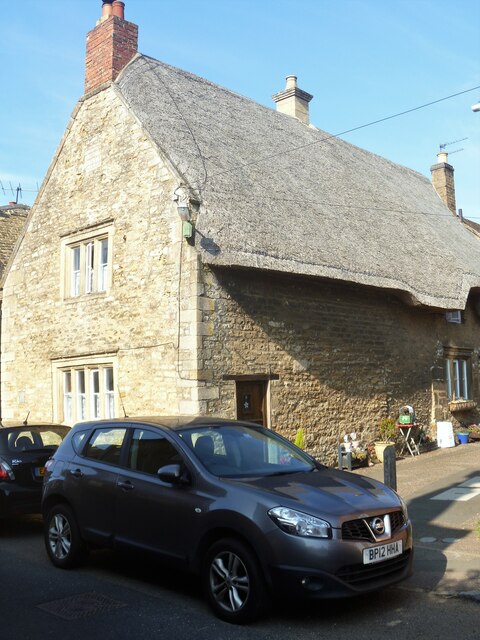
Image: © Michael Dibb Taken: 26 Sep 2021
Number 1 Lees Way is a 17th century house with its gable end to West Street. Constructed of coursed limestone rubble stone, under a roof that is thatch to the right slope, and slate to the left slope. Listed, grade II, with details at: https://historicengland.org.uk/listing/the-list/list-entry/1372397 Geddington is a village in Northamptonshire, on the main road between Kettering, about 3 miles southwest, and Corby, about 4 miles north. The River Ise runs through the village and is crossed by a medieval bridge. There is evidence of Iron Age, Roman and Saxon occupation. The village is home to the best preserved Eleanor cross of the three remaining. A Royal hunting lodge once stood to the north of the village but no trace remains.
Images are licensed for reuse under creativecommons.org/licenses/by-sa/2.0
Image Location
Latitude
52.438789
Longitude
-0.68663