Station Sawmills
Introduction
The photograph on this page of Station Sawmills by Kevin Waterhouse as part of the Geograph project.
The Geograph project started in 2005 with the aim of publishing, organising and preserving representative images for every square kilometre of Great Britain, Ireland and the Isle of Man.

There are currently over 7.5m images from over 14,400 individuals and you can help contribute to the project by visiting https://www.geograph.org.uk
Station Sawmills
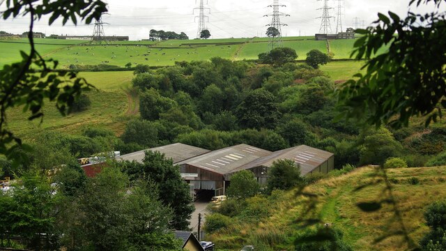
Image: © Kevin Waterhouse Taken: 17 Aug 2009
Sawmills on the site of Denholme Railway Station Yard and the tree filled cutting leading to Birk Hill Tunnel beyond. The sawmills have in turn gone and this is now a housing estate.
Images are licensed for reuse under creativecommons.org/licenses/by-sa/2.0
Image Location


Leaflet Map data © OpenStreetMap
Latitude
53.799012
Longitude
-1.888071