Former barns to the SW of Ercall Hall
Introduction
The photograph on this page of Former barns to the SW of Ercall Hall by Richard Law as part of the Geograph project.
The Geograph project started in 2005 with the aim of publishing, organising and preserving representative images for every square kilometre of Great Britain, Ireland and the Isle of Man.

There are currently over 7.5m images from over 14,400 individuals and you can help contribute to the project by visiting https://www.geograph.org.uk
Former barns to the SW of Ercall Hall
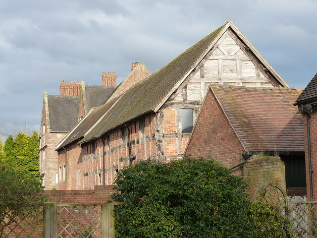
Image: © Richard Law Taken: 10 Mar 2022
The timber-framed barn, and the further brick barn beyond it, form part of the original farm buildings associated with Ercall Hall; they date to the 17th and 18th centuries respectively and were Grade II listed https://britishlistedbuildings.co.uk/101374389-farm-buildings-adjoining-south-west-of-ercall-hall-ercall-magna#.YjO36nrP3IU & https://historicengland.org.uk/listing/the-list/list-entry/1374389 in 1959. They are now converted to dwellings.
Images are licensed for reuse under creativecommons.org/licenses/by-sa/2.0
Image Location
Latitude
52.75274
Longitude
-2.603204