War memorial, Sandy Row, Belfast
Introduction
The photograph on this page of War memorial, Sandy Row, Belfast by Albert Bridge as part of the Geograph project.
The Geograph project started in 2005 with the aim of publishing, organising and preserving representative images for every square kilometre of Great Britain, Ireland and the Isle of Man.

There are currently over 7.5m images from over 14,400 individuals and you can help contribute to the project by visiting https://www.geograph.org.uk
War memorial, Sandy Row, Belfast
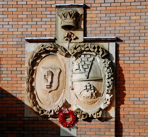
Image: © Albert Bridge Taken: 2 Mar 2008
This war memorial is outside the community centre in Sandy Row. My understanding is that it is a private memorial unconnected with Belfast City Council or the Royal British Legion. I seem to recall that it was erected during the redevelopment of the area in the eighties. The arms (if I remember correctly) came from the old tram depot in Utility Street. Another theory is that they came from the old Ulster Brewery Image Further information welcomed.
Images are licensed for reuse under creativecommons.org/licenses/by-sa/2.0
Image Location
Latitude
54.591695
Longitude
-5.937321