Storm damage at St Luke's Church
Introduction
The photograph on this page of Storm damage at St Luke's Church by Marathon as part of the Geograph project.
The Geograph project started in 2005 with the aim of publishing, organising and preserving representative images for every square kilometre of Great Britain, Ireland and the Isle of Man.

There are currently over 7.5m images from over 14,400 individuals and you can help contribute to the project by visiting https://www.geograph.org.uk
Storm damage at St Luke's Church
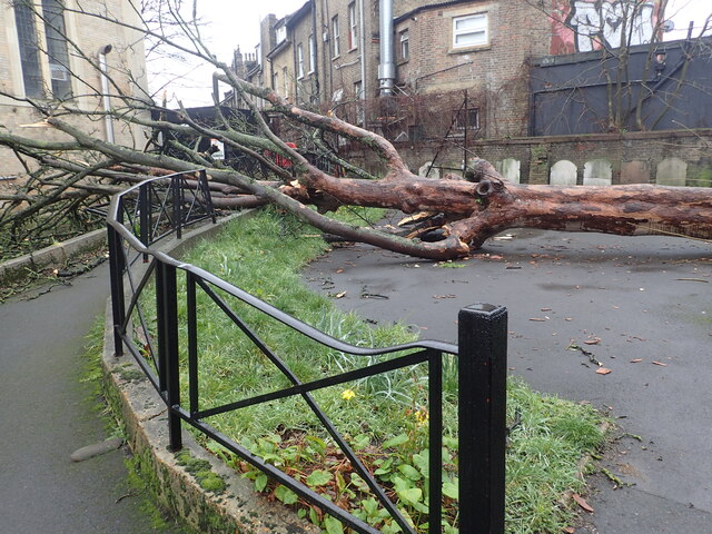
Image: © Marathon Taken: 1 Mar 2022
This tree, on the boundary of the churchyard with Knights Hill, only narrowly missed St Luke's Church. This was on 1st March and it would have been brought down by one of the three named storms of the previous month.
Images are licensed for reuse under creativecommons.org/licenses/by-sa/2.0
Image Location
Latitude
51.432195
Longitude
-0.103811