Edington School Room
Introduction
The photograph on this page of Edington School Room by Neil Owen as part of the Geograph project.
The Geograph project started in 2005 with the aim of publishing, organising and preserving representative images for every square kilometre of Great Britain, Ireland and the Isle of Man.

There are currently over 7.5m images from over 14,400 individuals and you can help contribute to the project by visiting https://www.geograph.org.uk
Edington School Room
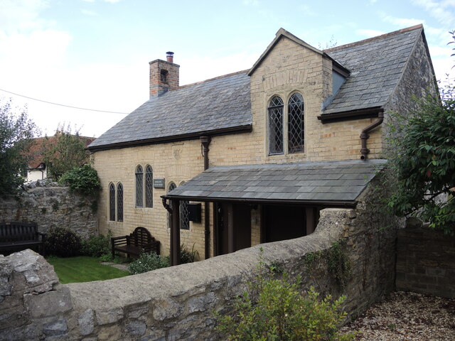
Image: © Neil Owen Taken: 14 Oct 2021
The building has a date stone of 1772 and is thought to have been originally a farm building. Schooling was primarily a philanthropic activity until the nineteenth century when more formal authorities took over the role. It carried on with Sunday teachings well after another school was built elsewhere. However, the various extensions and alterations were not up to modern standards (running water and toilets only arrived in the 1990s!) and the building was falling into disrepair. Efforts were made to secure funding and a charitable group now look after the community facility. Grade II listed structure.
Images are licensed for reuse under creativecommons.org/licenses/by-sa/2.0
Image Location
Latitude
51.154239
Longitude
-2.878869