Naturalising the pond
Introduction
The photograph on this page of Naturalising the pond by Richard Sutcliffe as part of the Geograph project.
The Geograph project started in 2005 with the aim of publishing, organising and preserving representative images for every square kilometre of Great Britain, Ireland and the Isle of Man.

There are currently over 7.5m images from over 14,400 individuals and you can help contribute to the project by visiting https://www.geograph.org.uk
Naturalising the pond
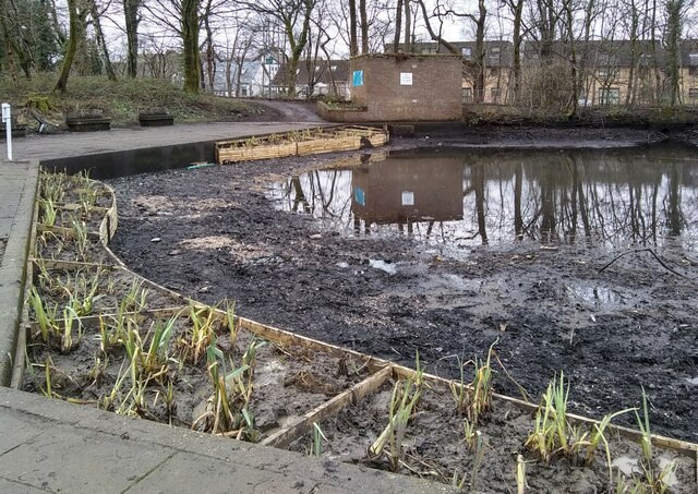
Image: © Richard Sutcliffe Taken: 28 Feb 2022
The water level of the pond beside Milngavie Community Library & Education Centre has been temporarily dropped. This is to allow work to be done to naturalise the edges of the pond. The work, to be carried out by Watergems, will promote the health of the water, biodiversity and provide shelter for wildfowl as well as providing a beautiful display of plants and flowers. So far the only planting appears to be of irises.
Images are licensed for reuse under creativecommons.org/licenses/by-sa/2.0
Image Location
Latitude
55.943887
Longitude
-4.321377