Hare Hill Road Closed
Introduction
The photograph on this page of Hare Hill Road Closed by Kevin Waterhouse as part of the Geograph project.
The Geograph project started in 2005 with the aim of publishing, organising and preserving representative images for every square kilometre of Great Britain, Ireland and the Isle of Man.

There are currently over 7.5m images from over 14,400 individuals and you can help contribute to the project by visiting https://www.geograph.org.uk
Hare Hill Road Closed
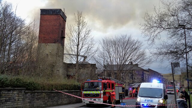
Image: © Kevin Waterhouse Taken: 24 Mar 2018
A fire at the former CWS Flannel Mill caused the closure of the road. The water tower was demolished as part of the demolition
Images are licensed for reuse under creativecommons.org/licenses/by-sa/2.0
Image Location
Latitude
53.645866
Longitude
-2.099196