Canterbury features [76]
Introduction
The photograph on this page of Canterbury features [76] by Michael Dibb as part of the Geograph project.
The Geograph project started in 2005 with the aim of publishing, organising and preserving representative images for every square kilometre of Great Britain, Ireland and the Isle of Man.

There are currently over 7.5m images from over 14,400 individuals and you can help contribute to the project by visiting https://www.geograph.org.uk
Canterbury features [76]
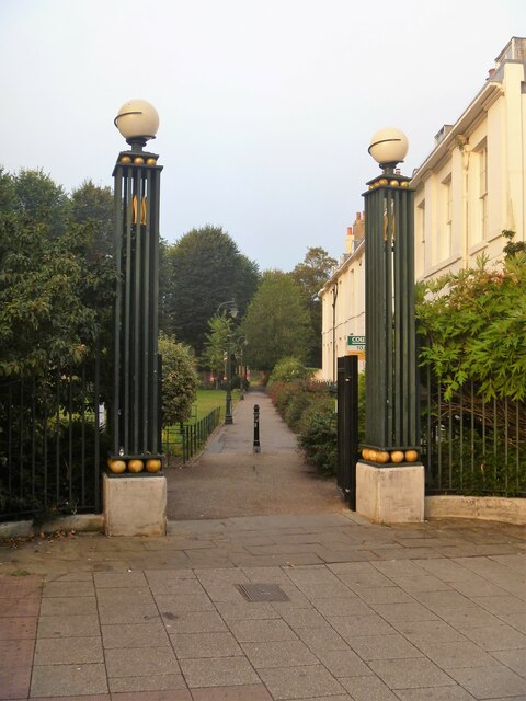
Image: © Michael Dibb Taken: 9 Sep 2021
The entrance gateway to Dane John Gardens from Watling Street. Dane John Gardens have been owned by Canterbury Council since 1836 although the open space has been used by the local people for centuries. The gardens were restored in the period 1994 to 1999. The gardens are on the Register of Historic Parks and Gardens, grade II, and there is much history and detail at: https://historicengland.org.uk/listing/the-list/list-entry/1001360 The gardens are also a Scheduled Ancient Monument with details at: https://historicengland.org.uk/listing/the-list/list-entry/1003780 Canterbury is a small historic city on the River Stour in Kent, some 54 miles southeast of London. Occupied since prehistoric times, it became an important Roman city. In 672, the see of Canterbury gained authority over the entire English Church. After the murder of Archbishop Thomas Becket at the cathedral in 1170, pilgrims from all parts of Christendom came to visit his shrine until the Dissolution. Today, Canterbury is a popular tourist destination and one of the most-visited cities in the United Kingdom. The city has a substantial student population, with four university campuses.
Images are licensed for reuse under creativecommons.org/licenses/by-sa/2.0
Image Location
Latitude
51.276003
Longitude
1.080028