Dirty Dingle
Introduction
The photograph on this page of Dirty Dingle by Graham Horn as part of the Geograph project.
The Geograph project started in 2005 with the aim of publishing, organising and preserving representative images for every square kilometre of Great Britain, Ireland and the Isle of Man.

There are currently over 7.5m images from over 14,400 individuals and you can help contribute to the project by visiting https://www.geograph.org.uk
Dirty Dingle
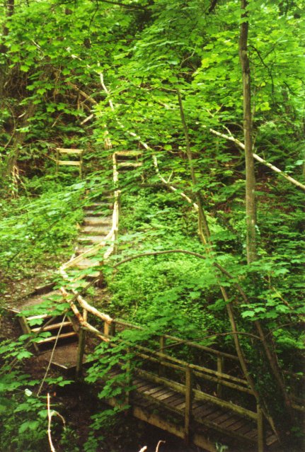
Image: © Graham Horn Taken: 5 Jun 2000
An infamous section of Offa's Dyke Path, a steep descent into Nanteris ravine followed by an even steeper exit. But it is now a doddle thanks to the construction of nearly 100 steps and a bridge.
Images are licensed for reuse under creativecommons.org/licenses/by-sa/2.0
Image Location
Latitude
52.919384
Longitude
-3.109034