Church of the Holy Trinity, Wyke Champflower
Introduction
The photograph on this page of Church of the Holy Trinity, Wyke Champflower by Tim Heaton as part of the Geograph project.
The Geograph project started in 2005 with the aim of publishing, organising and preserving representative images for every square kilometre of Great Britain, Ireland and the Isle of Man.

There are currently over 7.5m images from over 14,400 individuals and you can help contribute to the project by visiting https://www.geograph.org.uk
Church of the Holy Trinity, Wyke Champflower
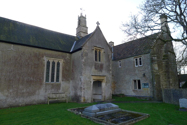
Image: © Tim Heaton Taken: 2 Feb 2022
Listed Grade I. A Jacobean (1623) church attached to the manor house, replacing an earlier chapel https://seearoundbritain.com/venues/holy-trinity-church-wyke-champflower-limited-opening-free-entry. The plaque near the end of the manor house wall commemorates Sir Duncan George Mackenzie, a former resident.
Images are licensed for reuse under creativecommons.org/licenses/by-sa/2.0
Image Location


Leaflet Map data © OpenStreetMap
Latitude
51.107082
Longitude
-2.484453