Burnhill, Strathpeffer
Introduction
The photograph on this page of Burnhill, Strathpeffer by Craig Wallace as part of the Geograph project.
The Geograph project started in 2005 with the aim of publishing, organising and preserving representative images for every square kilometre of Great Britain, Ireland and the Isle of Man.

There are currently over 7.5m images from over 14,400 individuals and you can help contribute to the project by visiting https://www.geograph.org.uk
Burnhill, Strathpeffer
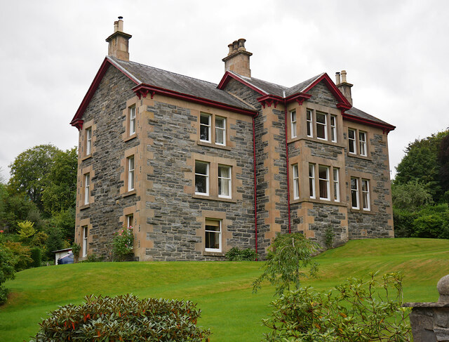
Image: © Craig Wallace Taken: 12 Sep 2021
A three-storey house, next to the old railway station. It was built in 1888, for the inspector of schools. Some details on the Highland Council HER. https://her.highland.gov.uk/Monument/MHG22284
Images are licensed for reuse under creativecommons.org/licenses/by-sa/2.0
Image Location
Latitude
57.590136
Longitude
-4.535763