Bruton Dovecote
Introduction
The photograph on this page of Bruton Dovecote by Chris Heaton as part of the Geograph project.
The Geograph project started in 2005 with the aim of publishing, organising and preserving representative images for every square kilometre of Great Britain, Ireland and the Isle of Man.

There are currently over 7.5m images from over 14,400 individuals and you can help contribute to the project by visiting https://www.geograph.org.uk
Bruton Dovecote
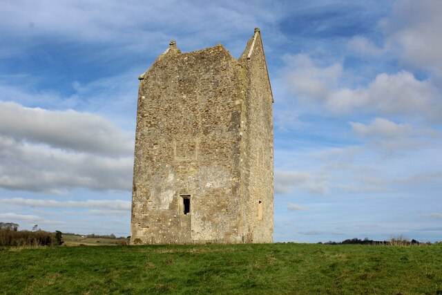
Image: © Chris Heaton Taken: 2 Feb 2022
Grade II Listed Building administered by the National Trust. Standing on a hill to the south of Bruton, the date of construction is not entirely known - somewhere between the 15th and 17th Century. It may have been a watchtower, before being converted to a dovecote. Looking inside it is slightly messy, and still occupied by several pigeons. More of an impressive exterior feature.
Images are licensed for reuse under creativecommons.org/licenses/by-sa/2.0
Image Location
Latitude
51.108197
Longitude
-2.453182