Boundary Road
Introduction
The photograph on this page of Boundary Road by Ian Capper as part of the Geograph project.
The Geograph project started in 2005 with the aim of publishing, organising and preserving representative images for every square kilometre of Great Britain, Ireland and the Isle of Man.

There are currently over 7.5m images from over 14,400 individuals and you can help contribute to the project by visiting https://www.geograph.org.uk
Boundary Road
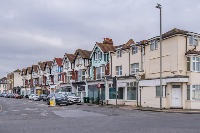
Image: © Ian Capper Taken: 21 Jan 2022
Terrace of early 20th Century shops/houses, first shown on the 1912 25 inch map. When first laid out (the road here is marked on the 1879 6 inch map, but with development on the west side only), this was named Station Road, since it led to Portslade Station. However that side was in Portslade, with the eastern side (here) being in Hove. Since Hove Station was further east, having the road named Station Road was considered confusing and so the Hove side was renamed Boundary Road. As a result, we now have a road with different names according to the side of the road.
Images are licensed for reuse under creativecommons.org/licenses/by-sa/2.0
Image Location
Latitude
50.829765
Longitude
-0.208389